
Review · SAN DIEGO DAY TRIPS
Self guided Driving Tour between LA and San Diego
A coast road trip with built-in stories. I like that this is self-guided, so you can stop for photos and snacks without racing a schedule. The narration-style facts turn a normal drive into something more like a rolling roadside walk—offline after the initial download.
Two things I really enjoy: the route is designed around real places (LAX, multiple beach towns, wildlife areas, and big landmarks), and it uses your drive time well with bite-size info. One thing to watch: external GPS apps may route you down the fast way and you can miss points, so stay close to the in-app direction flow.
In This Review
- Key things to know before you drive
- What this LA-to-San Diego drive feels like
- Price and value: $11.99 per group, up to 15
- Before you start: phone setup and staying on route
- Driving story stop by stop: LAX to early beach towns
- Los Angeles International Airport and why LAX is LAX
- El Segundo: name origins and local industries
- Manhattan Beach: how the name came to be
- Redondo Beach and its more notorious past
- Torrance and a Japanese automaker’s North American HQ
- Louis Zamperini: perseverance and resilience
- Palos Verdes views and the Queen Mary in Long Beach
- Palos Verdes: the land blessed by Native Americans
- RMS Queen Mary: how the ship became local
- Long Beach history and the original inhabitants
- A university and famous alumni
- Seal Beach, a wildlife refuge, and Surf City Huntington Beach
- Seal Beach: once a gambling destination
- Wildlife refuge: four habitats and supporting species
- Another quintessential beach town feeling
- The long and varied path to protecting the reserve
- Huntington Beach and why it’s Surf City
- Oil, tourists, politics at Huntington Beach
- From Santa Catalina pirates to Newport’s Balboa Peninsula
- Santa Catalina Island and pirates
- Newport Beach: sandy beaches with a deeper start
- Balboa Peninsula: from mudflat to tourism icon
- Crystal Cove, Laguna Beach, and Monarch Beach affluence
- Crystal Cove State Park and its 1874 roots
- Laguna Beach: scenic coastline and hills
- A regional wildlife preserve with trails and geology
- Monarch Beach: luxury and affluence by the shore
- Dana Point to San Diego edges: dolphins, Spanish towns, and San Onofre
- Dana Point: dolphin-and-whale capital of the world
- San Clemente: Spanish Village by the Sea
- San Onofre State Beach: factories and a nuclear power plant
- Vista Point: a place to rest
- Oceanside: the naming folklore
- Carlsbad, Encinitas, Cardiff, and the San Diego County scale
- Carlsbad and the Flower Fields
- Encinitas: named for trees and the Spanish expedition
- Cardiff State Beach: swimming, beachcombing, exploring
- Torrey Pines: San Diego County size and a final conservation stop
- San Diego County size
- Torrey Pines: 1,750 acres of conservation
- How to get the most out of a self-guided coastal route
- Should you book this LA to San Diego driving tour?
- FAQ
- How much does the LA to San Diego self-guided driving tour cost?
- How long does the tour take?
- Do I need a working internet connection during the tour?
- Do I need to bring a smartphone or tablet?
- Can I stop whenever I want while driving?
- Is this tour private?
- What language is the tour narration in?
- Can I cancel and get a refund?
- What hours is the experience available?
Key things to know before you drive
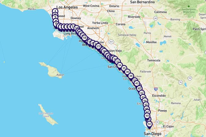
- 4–5 hours works well for a long single-day drive, and you can stretch it out with extra stops
- No time constraints means you can pause whenever you want
- Download first, then go offline during the tour once the content is loaded
- One booking per vehicle covers up to 15 people, so it can be a low-cost group option
- English narration is included for your car-time
- Use the in-app directions to avoid getting routed off the intended stops
Head south again with more San Diego day trips
- LA to San Diego: History, Harbor & USS Midway Magic in one day★ 4.0 · 24 reviews
- Self guided Driving Tour between LA and San Diego★ 3.5 · 6 reviews
- San Diego Private Tour★ 5.0 · 6 reviews
What this LA-to-San Diego drive feels like
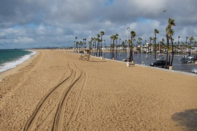
This is the kind of tour that fits real life. You’re in your own car, you control the exits, and you’re not stuck in a set-time group rhythm. The “tour” part is the audio-style guidance as you pass key places, giving names, origins, and quick context while you’re already heading down the coast.
The route timing is also practical. Expect about 4 to 5 hours on average, but there are no built-in time limits. That’s important because this is Southern California—traffic, parking, and weather can all change your best plan.
And the price? It’s $11.99 per group (up to 15). For a family, a small friend crew, or a couple with extra riders, that turns what could be an expensive guided day into something much more manageable.
Price and value: $11.99 per group, up to 15
Let’s talk value in plain terms. If you were to pay per person for a traditional guided drive, the per-head cost usually climbs fast. Here, the pricing is set per group and even covers up to 15 people per booking, which is a big deal if you can fill a vehicle.
It also helps that you only need one tour booking per vehicle. So if you’ve got a carpool setup—friends, extended family, or even a casual “let’s do a coastal day” plan—you’re not paying separately for every car.
The trade-off is what you’d expect from a self-guided format: it’s on you to drive safely, follow local rules, and manage your phone. If you’re hoping for a staff member to steer the whole trip, this isn’t that. But if you want flexibility and coast-to-coast story stops, it’s a strong value.
Before you start: phone setup and staying on route
This experience is designed to run inside an app on your smartphone or tablet. The tour guidance is meant to work without signal once you’ve downloaded it, which is handy along the coast where reception can be spotty.
Here’s the best practical approach:
- Make sure you have good mobile or Wi‑Fi connection for the initial download.
- Charge your phone. You’ll want the map and audio working reliably for the drive.
- Plan to rely on the tour’s in-app live map and directions rather than switching to an external navigation app mid-trip.
One key lesson from real use: if you set an external destination, your navigation app may choose highways/freeways that skip the exact points this route is built around. The fix is simple—keep the in-app directions as your primary way to stay lined up with the stops.
Driving story stop by stop: LAX to early beach towns

More Los Angeles outings we have rated and written up

Los Angeles International Airport and why LAX is LAX
The tour starts as you pass Los Angeles International Airport, with a quick explanation of what LAX stands for and why the name matters. Even if you fly a lot, airport naming can feel like trivia until someone gives it context—then you start seeing the airport as a real part of the region’s identity, not just a screen in the sky.
El Segundo: name origins and local industries
Next up is El Segundo, with a story about how the town got its name and what major industries have taken root there. This is a good early stop because it sets you up to notice the industrial coastline mix—busy, working, and not only about beaches.
If you want a quick break, this is one of those areas where you can pull over safely and read the audio while your eyes calibrate to the rhythm of coastal Southern California.
Manhattan Beach: how the name came to be
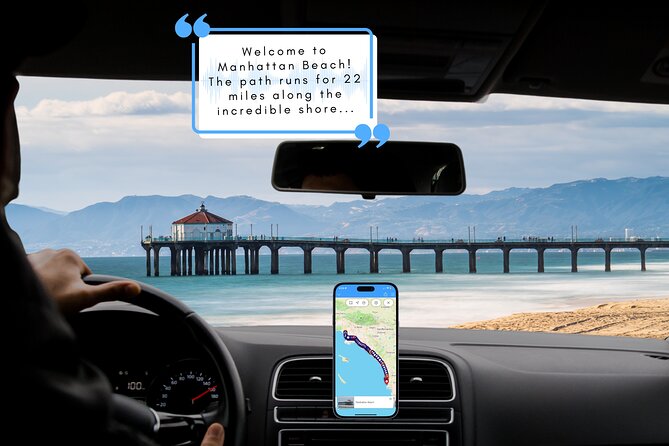
Then comes Manhattan Beach, with a legend behind its name. It’s the kind of story that makes you look at the beach town differently: the place is not just scenery, it’s a patchwork of naming, settlement, and local mythology.
Redondo Beach and its more notorious past
With Redondo Beach, the narration calls out a notorious past. You won’t just get “pretty coast” here—you get a reason the place has a reputation. That’s valuable on a drive like this because it breaks the monotone of sightseeing.
Practical tip: if you plan photos, do it quickly. Beach parking can be competitive, and the audio stops keep coming.
Torrance and a Japanese automaker’s North American HQ
Torrance follows, with the story of why the city has been a key location for a major Japanese automobile maker’s North American headquarters. It’s a reminder that this stretch of coast isn’t only resort land—it’s also a corporate and manufacturing corridor.
Louis Zamperini: perseverance and resilience
Then you get a short version of Louis Zamperini—built around perseverance and resilience. This is one of those “pause and listen” segments, because it gives you a human anchor amid the geography.
Palos Verdes views and the Queen Mary in Long Beach

Palos Verdes: the land blessed by Native Americans
As you reach Palos Verdes, the narration references a legend that Native Americans blessed the land, framing it as a place of beauty. Even if you’ve seen Palos Verdes from scenic pull-offs before, hearing it as a story tied to the land adds depth to what you’re actually seeing.
RMS Queen Mary: how the ship became local
Next: RMS Queen Mary, a retired British oceanliner that sailed the North Atlantic. You’re not only getting a ship name—you’re getting how she ended up here, which makes the museum-ship feel less random and more intentional.
If you’re the type who likes to stop for a walk, this is one of the best opportunities to turn the audio into a timed break—just check parking and allow time to get back to your car safely.
Long Beach history and the original inhabitants
After that, the tour moves into Long Beach history and its original inhabitants. This stop is helpful because Long Beach is easy to treat as a modern port and a boardwalk. Hearing the human history keeps you from flattening the area into only what’s visible today.
A university and famous alumni
Then you pass a university stop and hear about famous alumni who called it their own. That kind of detail is fun while driving, because it’s not just geography—it’s how people built influence from where they lived.
Seal Beach, a wildlife refuge, and Surf City Huntington Beach
Seal Beach: once a gambling destination
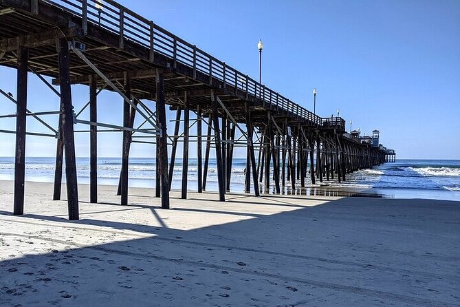
Seal Beach appears next with a story about how it used to be a gambling destination. That contrast—calm beach town now, but with a different past—helps you understand why these towns evolved into the vacation patterns you see today.
Wildlife refuge: four habitats and supporting species
Then you get a wildlife refuge segment, described through the idea of four different habitats supporting a variety of species. Even without a long hike planned, this is a strong informational stop because it explains what you’re driving past and why it matters ecologically.
In practical terms, it’s a reminder to keep your expectations realistic: you might not see wildlife on command, but you’re driving alongside habitat design.
Another quintessential beach town feeling
The next segment calls it a quintessential Southern California beach town. That’s a cue that the narration will shift tone back toward the everyday beach culture, with the kind of place-based identity that makes the route feel like it belongs to the region.
The long and varied path to protecting the reserve
After that, the tour shares the shortened version of how protection for the reserve came about. This adds weight to the wildlife stop, because you learn it wasn’t instant or automatic—it took effort and a mix of paths.
Huntington Beach and why it’s Surf City
Huntington Beach brings the famous branding: why it’s called Surf City. This is one of the most “name matches vibe” stops on the drive—use it to notice surfers, beachfront energy, and the cultural tone that makes the town feel distinct.
Oil, tourists, politics at Huntington Beach
Then the tour adds a more complicated layer: Huntington Beach and oil, and tourists, and politics. That combination is exactly what makes this stretch of coastline interesting. It’s not either/or: it’s economic history, tourism growth, and community debate happening in the same places.
From Santa Catalina pirates to Newport’s Balboa Peninsula
Santa Catalina Island and pirates
Next, you hear why Santa Catalina Island was popular with pirates. Again, this is one of those storytelling beats that turns “offshore island scenery” into a chapter of seafaring lore.
If you’re trying to decide whether to take a ferry someday, this kind of detail is what makes the idea feel more real—there’s a reason people talked about the island long before today’s tourism.
Newport Beach: sandy beaches with a deeper start
Now you reach Newport Beach, described as a seaside city known mostly for sandy beaches and ocean fun, but with a hint that it once supported a large number of something—suggesting a more layered origin story.
This is a good time to adjust your mindset: you’re about to hit a section where you can keep the car moving and still build a sense of continuity between towns.
Balboa Peninsula: from mudflat to tourism icon
Then comes the Balboa Peninsula, with the backstory that Balboa Island started as a mudflat surrounded by swampland. That origin detail is great because it makes the modern “beach fun” landscape feel like a human transformation, not just a nature scene.
Crystal Cove, Laguna Beach, and Monarch Beach affluence

Crystal Cove State Park and its 1874 roots
As you drive along the coast, you’ll see signs for Crystal Cove State Park. The tour frames it back to 1874, when a land owner and founder started the story that eventually shaped the park. This helps you connect the coast you see today to the long timeline behind coastal land ownership and preservation.
Laguna Beach: scenic coastline and hills
Next is Laguna Beach, where the narration points to the scenic beauty of the isolated coastline and hills as a pull factor. It’s a place name you may have heard, but hearing why it attracted people in the first place helps explain why it looks like it does.
A regional wildlife preserve with trails and geology
Then you’re told about an important regional wildlife preserve, plus trails for hiking, mountain biking, and horseback riding, and the mention of interesting geology. Even if you don’t stop to ride or hike, this helps you understand why the area feels designed for both recreation and conservation.
Monarch Beach: luxury and affluence by the shore
Monarch Beach is next, described in terms of luxury and affluence and the average home prices implied by the narration. This stop gives you a reality check about who the coastline serves—and how the views can come with a cost, literally and socially.
Dana Point to San Diego edges: dolphins, Spanish towns, and San Onofre
Dana Point: dolphin-and-whale capital of the world
Dana Point is framed as the dolphin-and-whale capital of the world, with the claim of more dolphins per square mile. Even if you don’t get sea life on your drive, the narration gives you a reason to think about the region’s marine life reputation.
If you’re the type who loves marine-biology facts, this is a good stop to mentally “zoom in” even from the car.
San Clemente: Spanish Village by the Sea
Then comes San Clemente, called the Spanish Village by the Sea. That phrase matters because it tells you to watch for architectural and cultural cues, not just beach scenery.
San Onofre State Beach: factories and a nuclear power plant
As you pass San Onofre State Beach, you also get the heads-up about factories and a nuclear power plant. This is a reminder that the coast you’re driving through is part of a working region. It’s not only postcard views—it’s power, industry, and complicated land use.
Vista Point: a place to rest
A quick stop for Vista Point is included, described as a nice lookout and a good rest spot. This is where I’d plan a short stretch, especially if you’re doing the drive in one go.
Oceanside: the naming folklore
Then Oceanside gets a story: folklore says the name was chosen by people describing the area in plain terms. It’s a small moment, but it helps you understand that place names often come from everyday language rather than grand history.
Carlsbad, Encinitas, Cardiff, and the San Diego County scale
Carlsbad and the Flower Fields
Carlsbad comes with the Flower Fields, blooming in a defined season. This is useful if you’re flexible with timing: if you want a particular kind of coastal day—color, photo moments, and seasonal attraction—this gives you a direction.
Encinitas: named for trees and the Spanish expedition
Next is Encinitas, named for its trees. The narration also references Gaspar de Portolá leading a Spanish expedition through the area. That specific name is a nice “anchor” detail, because it ties a modern beach city back to exploration-era context.
Cardiff State Beach: swimming, beachcombing, exploring
Then Cardiff State Beach is highlighted for swimming, beachcombing, and exploring. This is one of the practical stops on the route: it reads like permission to plan a casual break rather than just pass by.
Torrey Pines: San Diego County size and a final conservation stop
San Diego County size
Before the final stretch, you’re reminded that San Diego County spans 4,526 square miles. That scale framing helps you avoid underestimating how much you’re driving. This isn’t just a short hop; it’s a large region with very different coastal identities.
Torrey Pines: 1,750 acres of conservation
Finally, you reach Torrey Pines, described as 1,750 acres devoted to conservation of wildlife and waterfowl. This last segment is where the drive’s “story” theme pays off: you end with a conservation focus that explains why this coastline isn’t only a scenic backdrop.
It’s also a good place to park for a short view and wrap your day—because by the time you get here, you’ll likely feel like you’ve earned it.
How to get the most out of a self-guided coastal route
This experience works best when you treat it like a road trip, not a checklist. Since there are no time constraints, I recommend planning your own “anchor stops” where you’ll actually walk around, and leaving the rest as listen-and-glance moments from the car.
A couple more practical tips:
- If you’re splitting it over two days, it tends to feel less rushed and more like real sightseeing. The audio helps, but coastal driving is still driving.
- Keep your eyes on safe pull-offs. Some of these towns are busy, and parking can turn an easy photo stop into a time sink.
- Follow the in-app route for staying on the intended stop order, especially if you’re relying on your phone for guidance.
Should you book this LA to San Diego driving tour?
Book it if you want an affordable way to turn a coast drive into something more meaningful than scenery. The $11.99 per group setup can be great value, especially when you’re bringing a small crew, and the offline-first setup can save you from data anxiety.
Skip it (or at least plan carefully) if you prefer relying on your external GPS app for routing. The route is designed around specific stops, and external directions can push you off the intended path.
If you want a flexible, story-driven day with beach towns, named places, and conservation-minded endings, this is a smart fit. Download ahead, keep the in-app guidance on, and enjoy the drive like it’s part of the vacation.
FAQ
How much does the LA to San Diego self-guided driving tour cost?
It costs $11.99 per group, up to 15 people.
How long does the tour take?
It takes about 4 to 5 hours on average.
Do I need a working internet connection during the tour?
You need good mobile or Wi‑Fi connection for the initial download. During the tour, no signal or data is required.
Do I need to bring a smartphone or tablet?
Yes. A smartphone or tablet is not included.
Can I stop whenever I want while driving?
Yes. There are no time constraints, and you can stop at attractions as long as you like.
Is this tour private?
Yes. It’s a private tour/activity, and only your group participates.
What language is the tour narration in?
The tour is offered in English.
Can I cancel and get a refund?
Yes. You can cancel up to 24 hours in advance for a full refund.
What hours is the experience available?
The opening hours listed are Monday through Sunday, 12:00 AM to 11:30 PM.
More Tours in Los Angeles
- Warner Bros. Studio Tour Hollywood
★ 4.5 · 5,246 reviews - Hollywood, Beverly Hills & Celebrity Homes Tour by Open Air Bus
★ 5.0 · 2,557 reviews - Hollywood Sign 2.5-Hour Tour with Comedians and Their Dogs
★ 5.0 · 2,496 reviews - Full-Day LA Tour: Santa Monica, Hollywood and Beverly Hills
★ 5.0 · 2,431 reviews - Hollywood and Celebrity Homes Bus Tour
★ 4.5 · 2,074 reviews
More Tour Reviews in Los Angeles
- Full-Day Iconic Sights of LA, Hollywood, Beverly Hills, Beaches and More
★ 5.0 · 6,147 reviews - Warner Bros. Studio Tour Hollywood
★ 4.5 · 5,246 reviews - Hollywood, Beverly Hills & Celebrity Homes Tour by Open Air Bus
★ 5.0 · 2,557 reviews - Hollywood Sign 2.5-Hour Tour with Comedians and Their Dogs
★ 5.0 · 2,496 reviews - Full-Day LA Tour: Santa Monica, Hollywood and Beverly Hills
★ 5.0 · 2,431 reviews
More San Diego Day Trips
- LA to San Diego: History, Harbor & USS Midway Magic in one day
★ 4.0 · 24 reviews - LA Day Trip to Casinos, Palm Springs, San Diego, Santa Barbara
★ 5.0 · 12 reviews - San Diego Private Tour
★ 5.0 · 6 reviews - Los Angeles: private tour to San Diego
★ 5.0 · 4 reviews - The Los Angeles Highlights Day Tour from San Diego
★ 5.0 · 3 reviews
Keep exploring Los Angeles: fresh reviews from around town




San Diego Day Trips, compared.
 ★ 4.0LA to San Diego: History, Harbor & USS Midway Magic in one dayFrom $25424 reviews
 ★ 5.0LA Day Trip to Casinos, Palm Springs, San Diego, Santa BarbaraFrom $1,29512 reviews
 ★ 5.0San Diego Private TourFrom $8496 reviews
 ★ 5.0private tour to San DiegoFrom $8204 reviews
 ★ 5.0The Los Angeles Highlights Day Tour from San DiegoFrom $3993 reviews
Browse the lists this tour appears in